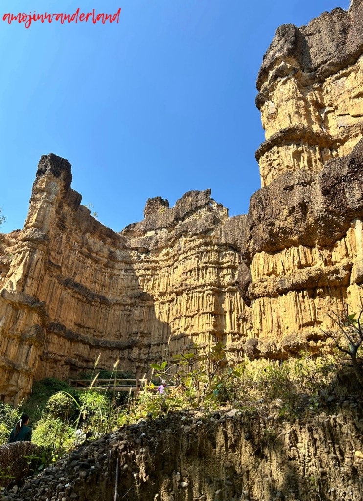
Pha Chor Canyon is located in Mae Wang National Park in northern Thailand and is the result of long-term geological processes. The site was formed after the Ping River changed its course many years ago. When the river shifted, sediment was left behind, creating a raised area that was gradually shaped by erosion. Over time, wind and rain wore down the soft soil, transforming the former hill into steep cliffs and tall soil pillars.
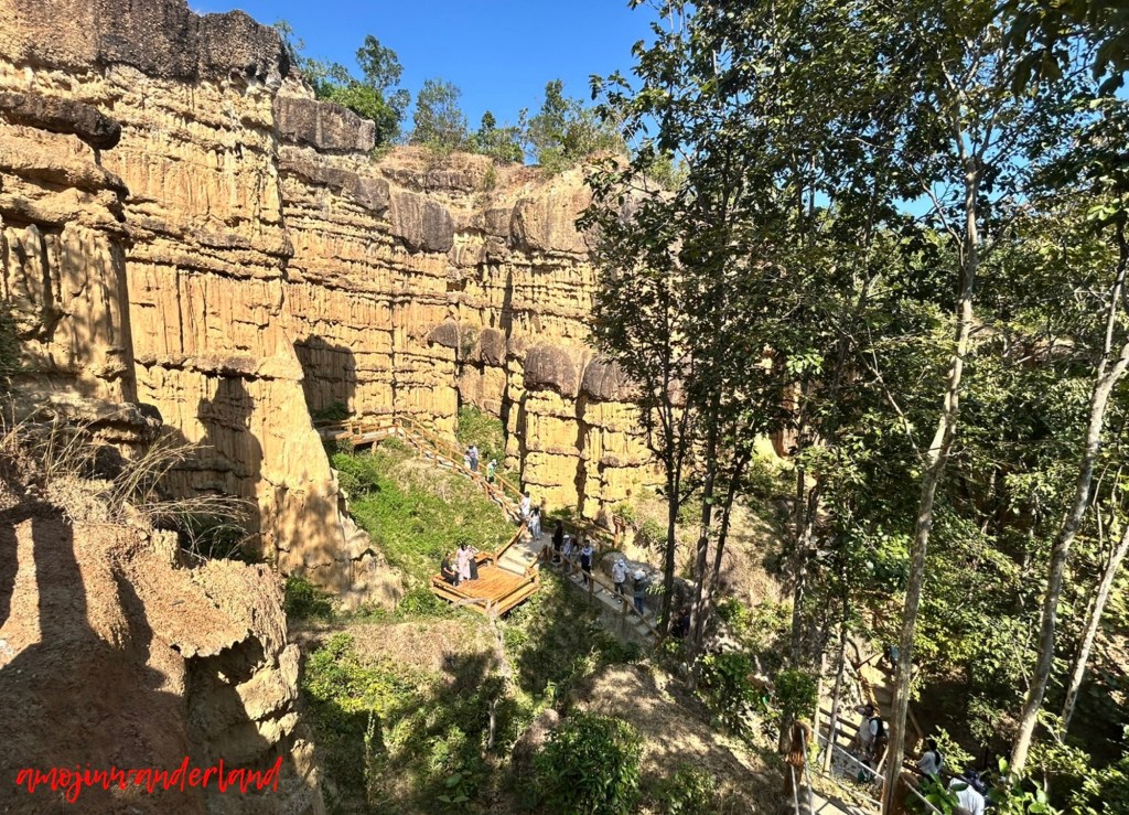
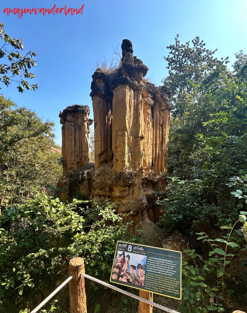
The canyon’s most distinctive features are its vertical walls and pillars, which reach about 30 metres in height. These formations consist mainly of soil, sand, and clay deposited during the late Tertiary period along the edge of the Thanon Thongchai Range. Subsequent tectonic uplift exposed the sediments, and continued erosion shaped them into the narrow passages and sheer faces visible today.
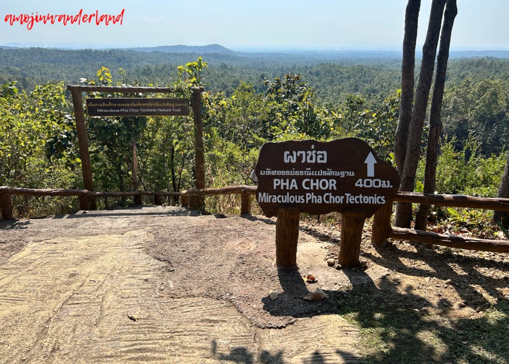
The walking route at Pha Chor is clearly defined. From the car park, a small café marks the starting point of the trail. The loop begins to the left of the café and takes approximately 45 to 60 minutes to complete, covering about 400 metres each way. The first section descends via a series of steps to viewpoints overlooking the canyon.
The trail then leads down to the canyon floor, where a narrow path runs between the eroded rock beds. This section allows close observation of the sediment layers and the depth of the canyon walls. The loop ends with a steep uphill climb back to the car park.
